


Looking for Loch Logan....a lost designed landscape near Gargunnock

Welcome to Stirling Archaeology’s regular piece of Friday research, the second of two weekly blogs compiled by Dr Murray Cook. The Monday newsletter summarises of all the interesting history and archaeological things happening round Stirling and the Friday one presents research. Both are generally free but if you like what I do and want to help please consider becoming a paid subscriber. Regardless we hope you enjoy the blogs and perhaps you’ll come along to a dig sometime!
The other Sunday I went for a walk through the former grounds of Leckie House from Gargunnock, along the old military road, past Knock-o-Ronald to Loch Logan. Its a great wee walk though very hard at the end due to the rhododendron growing out of control.
Now the first thing to note is that the designed landscape (which runs to the south of Leckie estate) was not there is in the 18th century. It is a product of increased wealth in the estate. Old Leckie House is 17th century in origin but the house that currently dominates the state Watson House is 19th century (it was called Leckie when first built) and its likely that its owners created the broader designed landscape. The landscape was a series of paths that ran from the house up the Leckie Burns past a variety of waterfalls to finish at an artificial loch with fantastic views to the north.

The walk begins in Gargunnock and follows the old military road built in the 18th century following the 1715. The Gargunnock end has just been upgraded (Bravo!).
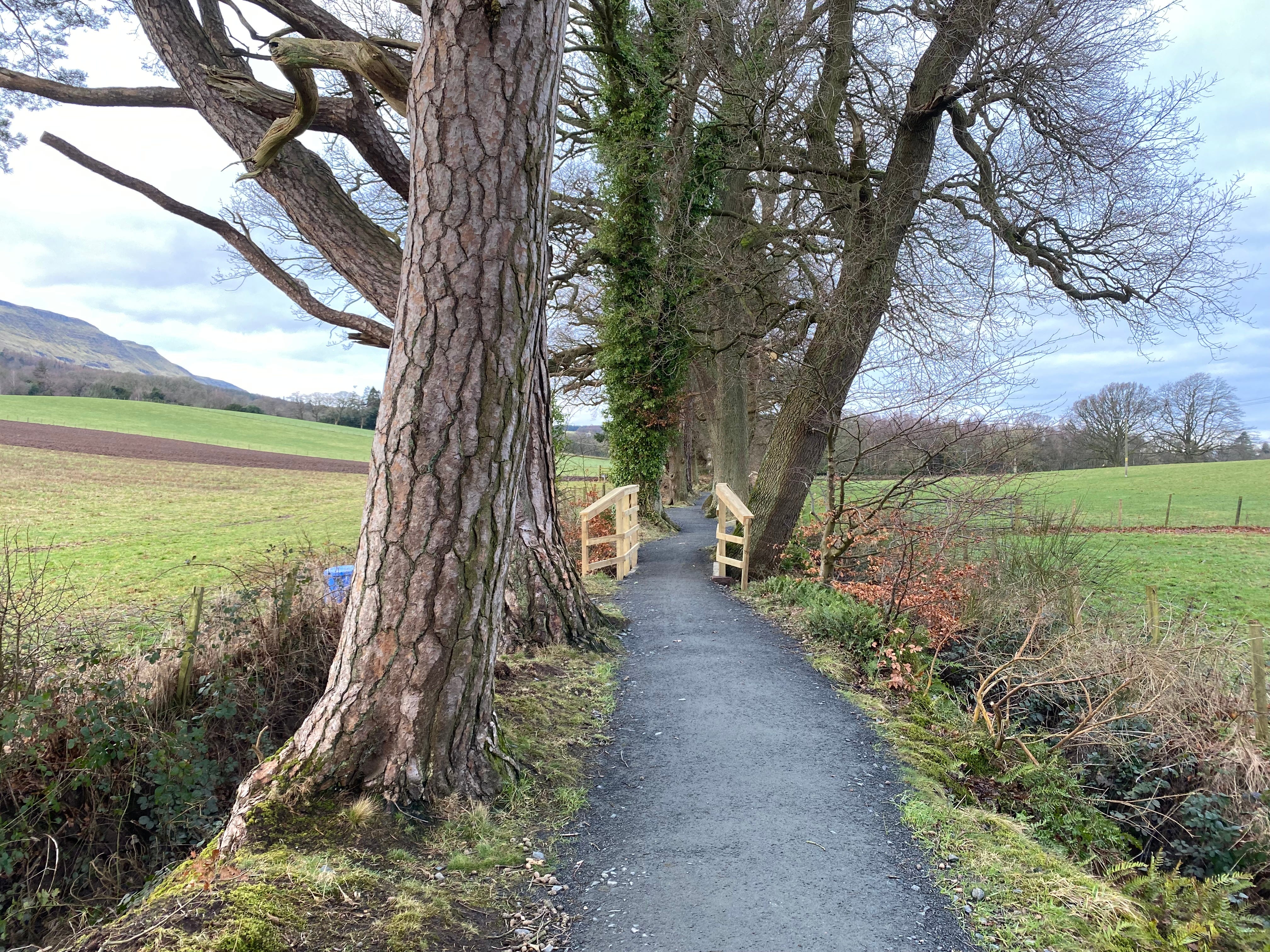
The upgraded path looking west.
As the road passes Watson House, there is a curious feature…a bank to the north. I wondered if this might be spoil from the road but I think its more likely to be a screen to ensure people travelling on the road did not spoil the view!
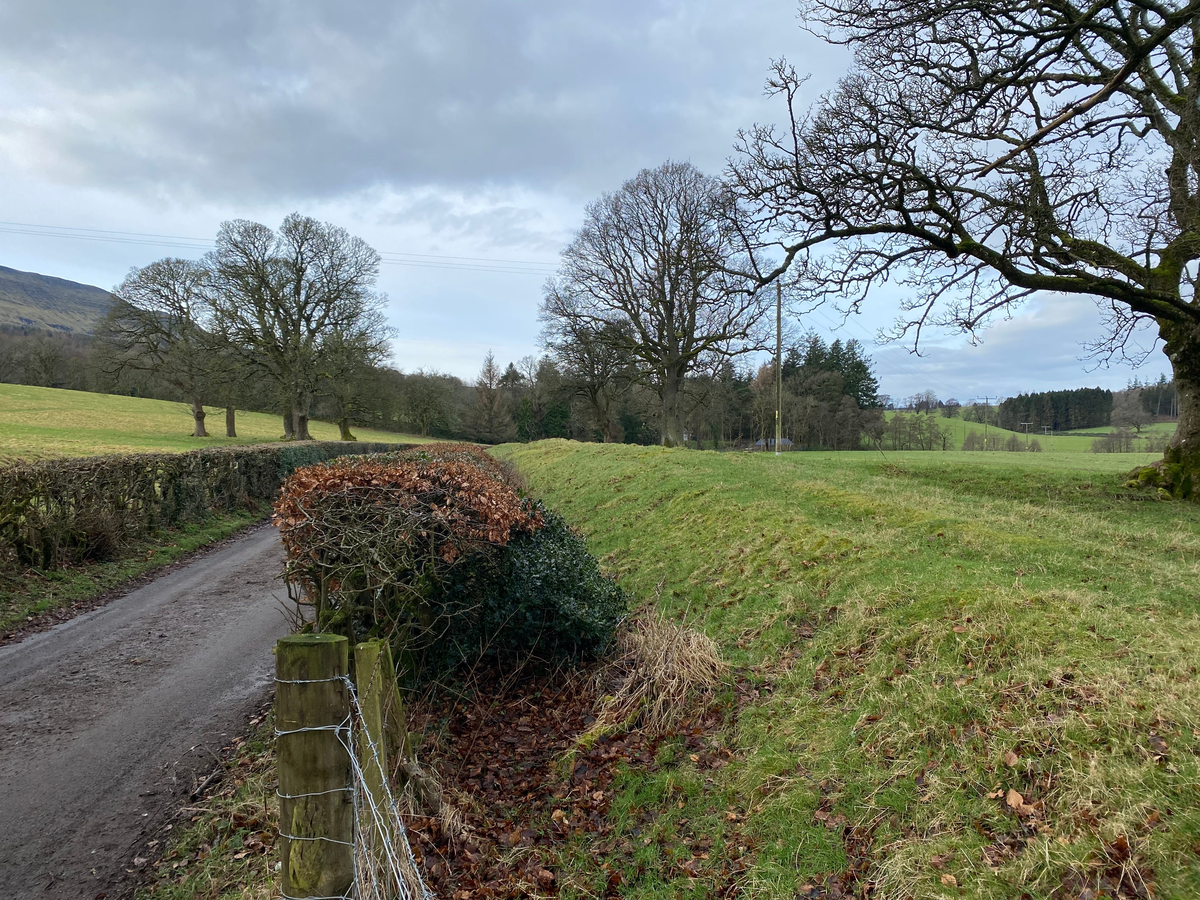
As you cross the Leckie Burn, you in theory cross the path of the walk that runs through the designed landscape that started at Leckie.
Now unfortunately it is very tricky to follow the burn all the way to Loch Logan but its worth a wee detour up this section as this is where Leckie Broch and its stunning rock art is.
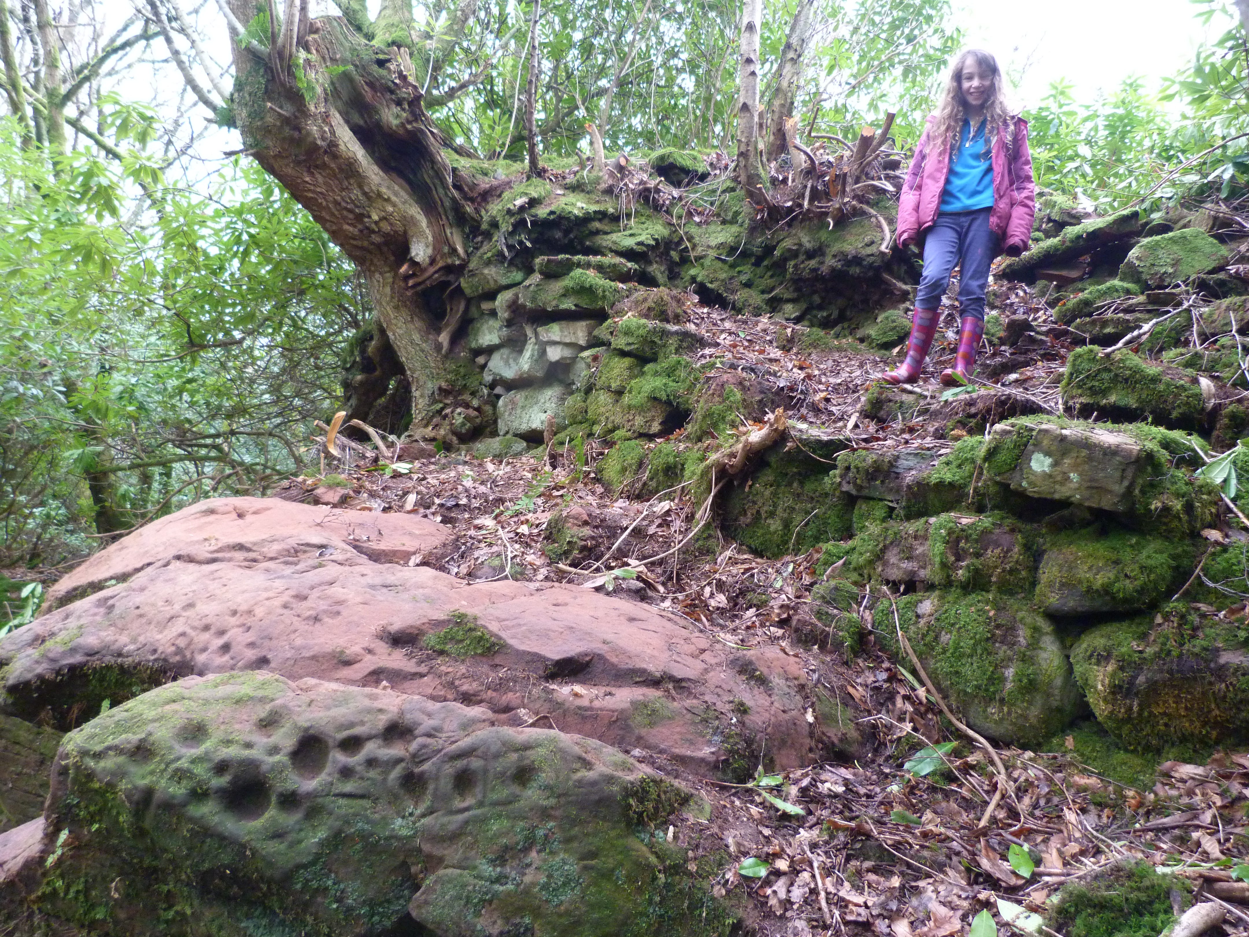
My youngest daughter Heather on the wall of the broch above the rock art.
I followed the road to Knock-o-Ronald, now I don;t know the history of this but ‘knock’ is likely to be Gaelic cnoc which means wee hill. Just after the farm is a wood to the west which is known as Spittalton Wood. This likely reflects either a medieval monastic hospital (spittal) or more likely a farm or grange owned by them. Perhaps the most likely is Inchmahome Priory.
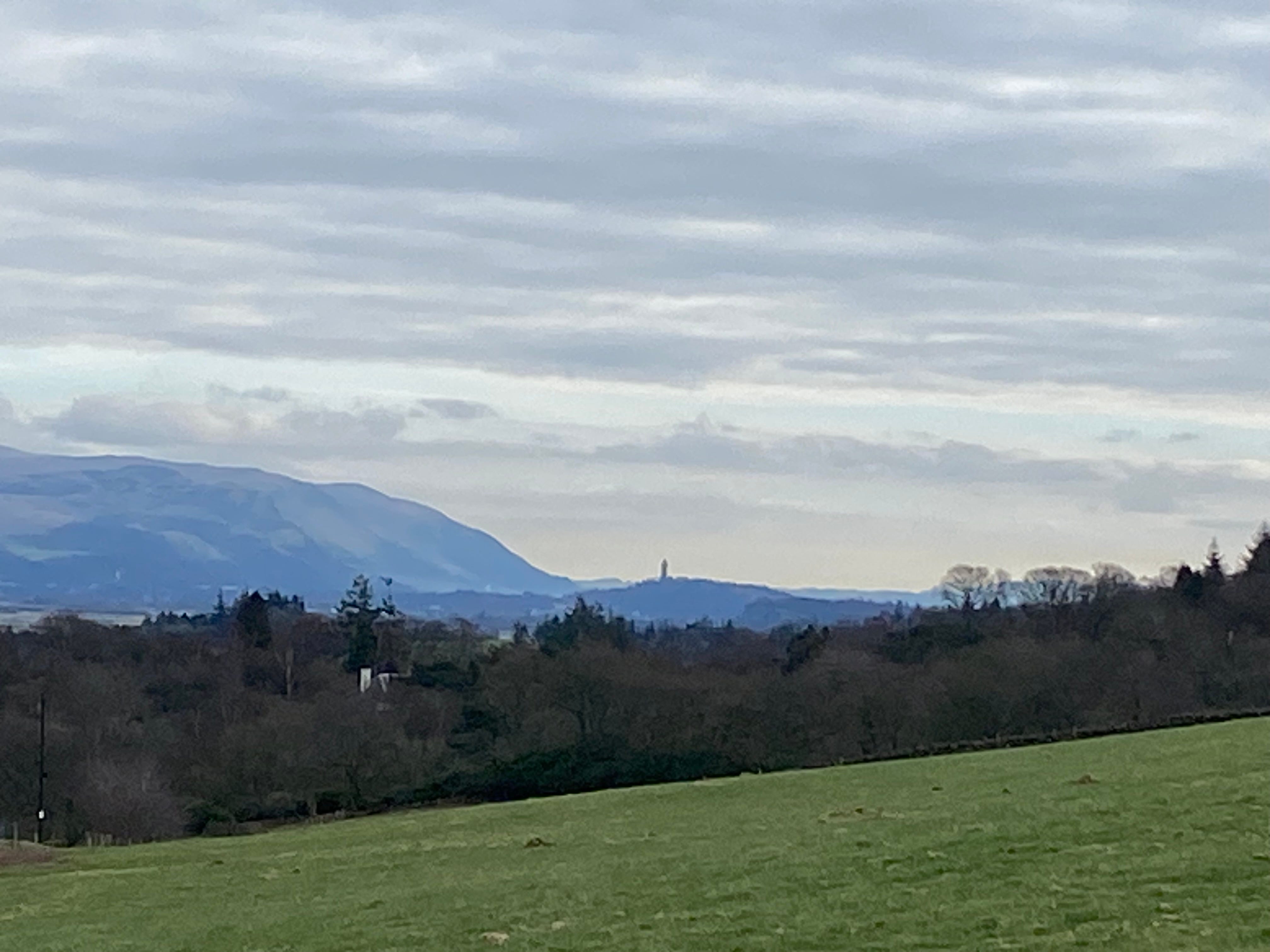
The view back east here to the Wallace Monument is one of favourites.
Keep walking on the farm road!
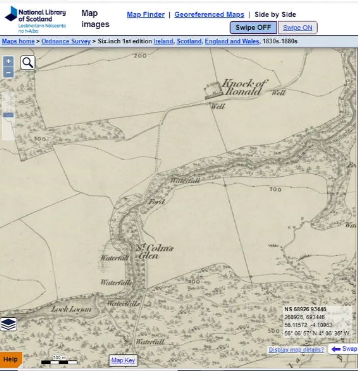
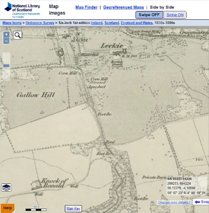
As this next extract of the mid-19th century 1st edition makes clear the path was intended to follow a circle round St Colm’s Glen, making the most of the waterfalls before terminating at Loch Logan which has great views to the north. All of this is heavily overgrown by laurel and rhododendron but the path is visible in places. The wee wood round the site is bounded by a beech hedge to the north and the eastern side of Loch Logan has some deliberate planting of Scots pines.
The best way to get there now is from the north immediately after the wee bridge rather than from the south through the wood…which is what I did!
Loch Logan is entirely artificial and there is a dam to its eastern side. It is now a choked wee pond a fraction of its former self.
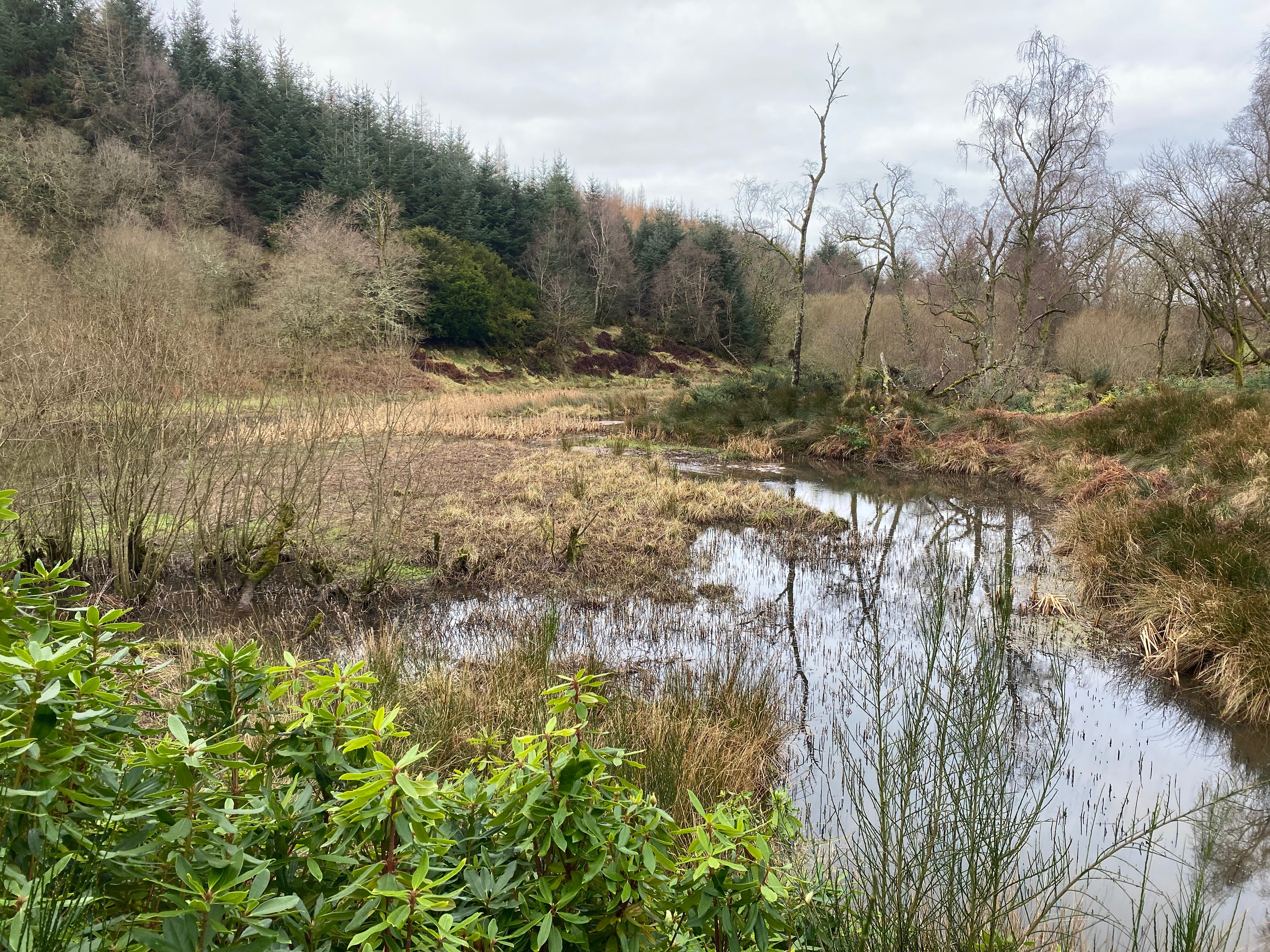
The remains of Loch Logan.
Before going on its worth talking about St Colm’s Glen. While this is noted by Glasgow University’s Saint Place Name Data base its not clear if the name has any real antiquity or is a romantic addition. However, its possible its a reference to St Columba who of course is who Inchmahome Priory was dedicated to. Columba was the founding Abbot of Iona Monastery and dedications to him in Stirling are sometimes argued to reflect Pictish influence after the Battle of Dunnichen in 685 when the Picts pushed the Northumbrians out to the south.
Sorry I can’t find anything about who Logan was!
Now if you do try this walk and you find the traces of the footpaths through the wood you will find that they were frequently quarried and must have cost a fortune. The paths cease to be marked after the 1950s and so presumably the money must have been running out. And in one final economic change the land that was ploughed in the 18th century (see Roy’s maps above) is now turned over to forestry.
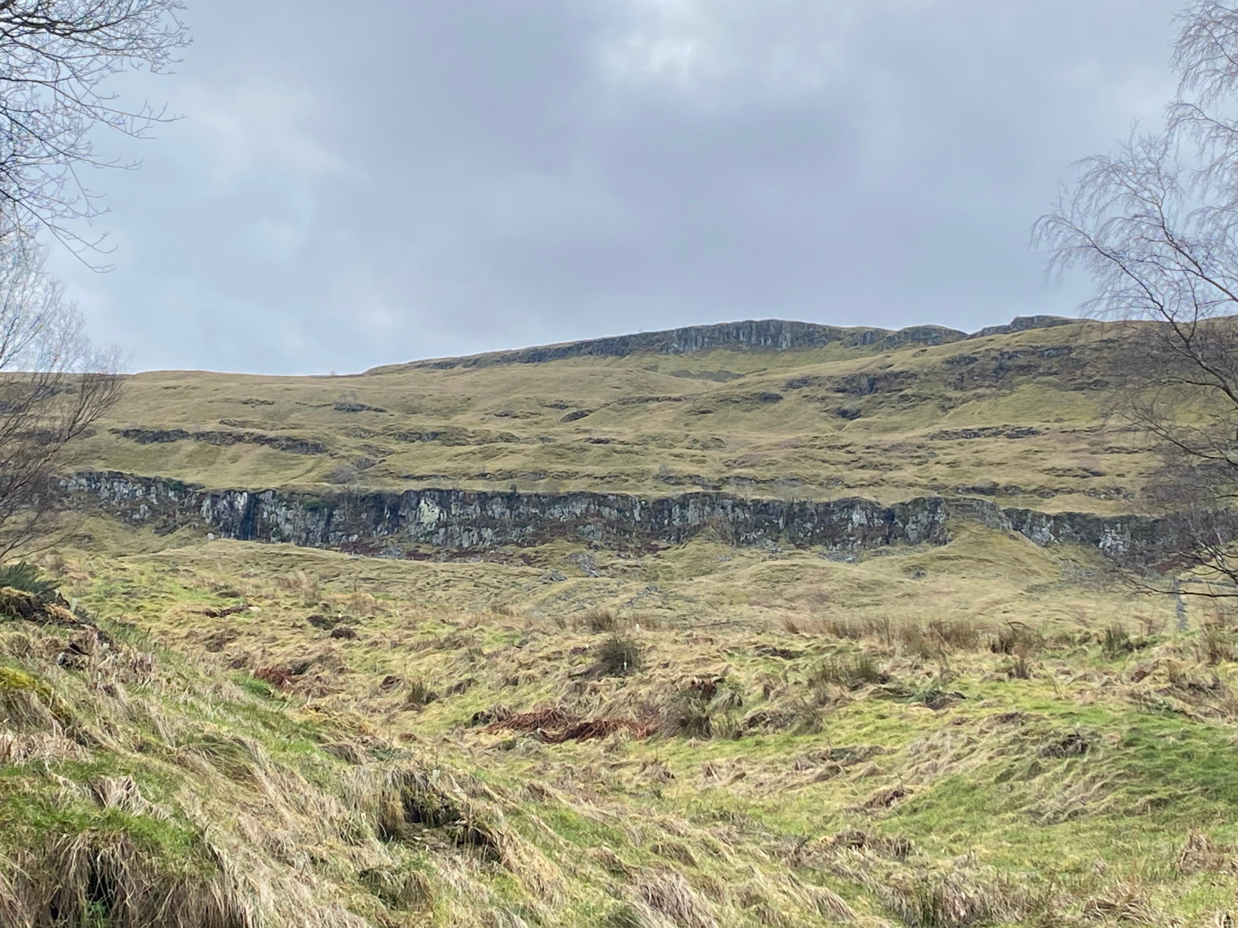
But don’t stop here keep going along the farm track to the south and get above the woodlands to the looks at the cliff faces which is magnificent! But the best way to explore these is via Gargunnock and Downie’s Loup an follow the burn up.
and to finish on the way back I recommend the home made ice cream in The Woodhouse!
I used to live in Watson House and you are right about the purpose of that bank. It was to hide the public. I believe the original road (Dumbarton Road?) was the one that ran in front of the house, but they made that private and moved the public road south, behind the man-made bank.