


Stirling's City Walls, The Best Preserved in Scotland: Part 1....missing bastions!

So first of all an apology for an anachronism….when they were built 1547/8 Stirling had burgh walls our city status came later.
There was likely always something at Stirling, its strategic location at the lowest crossing point of the Forth meant it could never be ignored. That name of course means either the lowest crossing point or the upper navigable point over what medieval map makers called the Sea of Scotland…an imagined combination of the Forth, The Clyde and Flanders Moss. However, the strategic reality of Scotland’s bottle neck was clear.
The Royal Burgh of Stirling was established in roughly 1124 by David I, quite what was there already is unknown but burgh’s created defined monopolies in which trade took place and from which the King took a cut. Each burgess of a burgh was responsible for maintaining their section of the burgh boundary. In Stirling this was likely quite easy given cliffs to the north and boggy ground to the south.
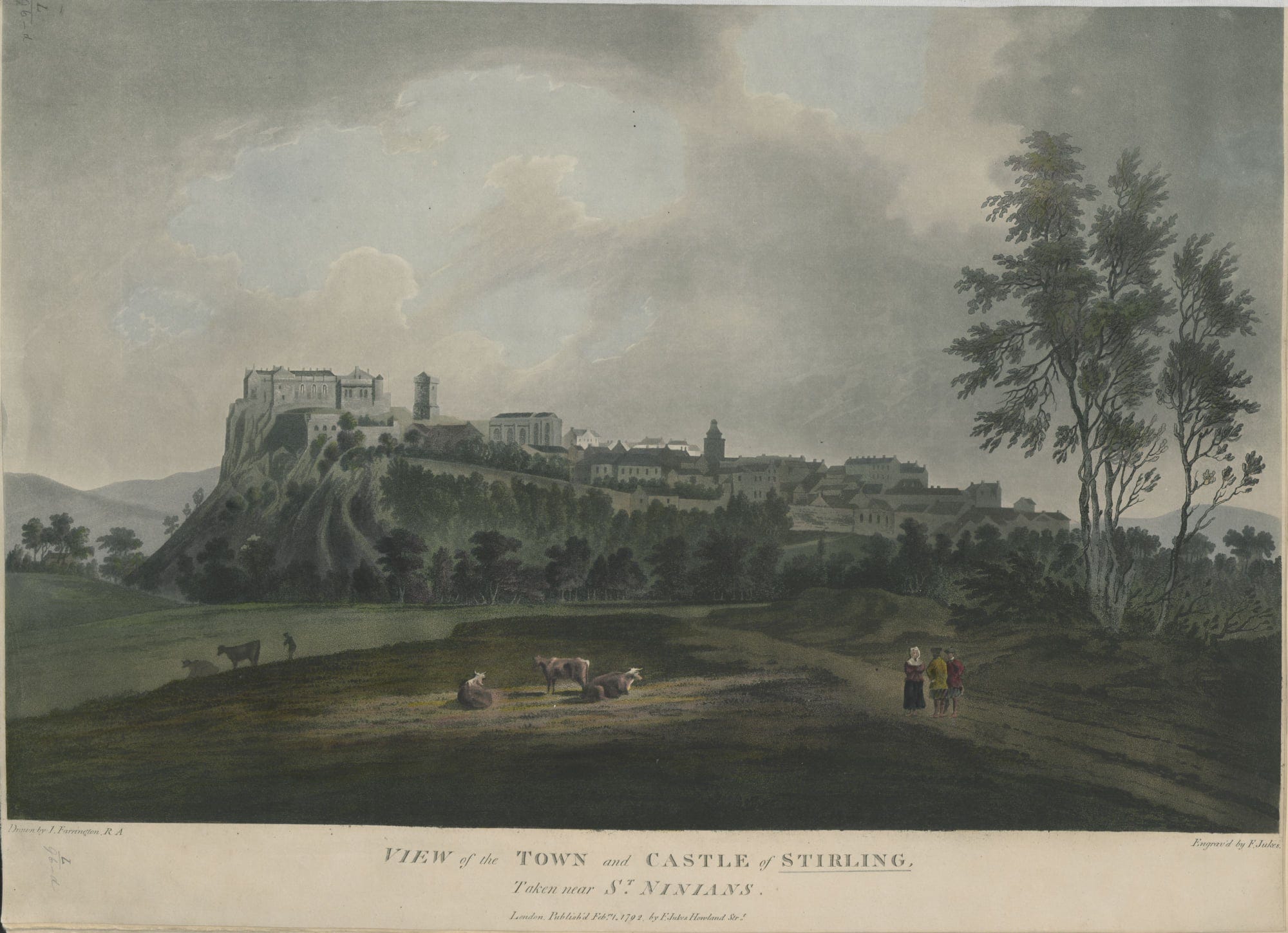
These boundaries were rapidly formalised in 1547 after the defeat of the Scottish army at the Battle of Pinkie in September. This battle and its repercussions formed a period in Scottish history known as the 'Rough Wooing', when English forces under the 'Protector Somerset' attacked Scotland to force a marriage between Mary Queen of Scots and Prince Edward. The Stirling wall continued to be operated, maintained and repaired to varying degrees into the 18th century, with strengthening and upgrades undertaken in 1571, 1650, 1651, 1685, 1688 and finally during the Jacobite campaign of 1745-6. Now as was noted at the time of the ‘45 the wall only runs to the south and not the north. This was not some failed Government procurement scheme but rather a deliberate strategic development. The north was protected by the Forth and a network of lades, mill ponds and boggy areas. The key to these northern defences was of course Stirling Bridge which had two gates and was patrolled by sentries.

An 18th-century depiction of Stirling Old Bridge by John Berrihil courtesy the Smith Museum and Art Gallery.
Given the rapid construction and also the rapid evolution of artillery it is possible that the wall is of not just National Significance (and its is!) but international significance.

James VIth of Scotland 1st of England
Significantly, following the Union of the Crowns, Stirling went from being a very important place to a regional backwater and there was a period of decline. This meant that unlike Edinburgh whose city walls were burst through by development. Stirling’s were preserved in isolation until its 19th century expansion. At this point the walls were preserved as an element of a boulevard type feature between the old town and the new town of King’s Park. This was framed by the upper and lower Back Walks with a series of public buildings: two church the Albert Halls, the Smith Museum and then the magnificent full stop of the King’s Knot and the view west!
There were however several losses through the 19th and early 20th centuries but what survives is clearly the best preserved city wall in Scotland. However, astonishingly the wall has never been recorded and we don’t even know how long it is! This is my starting for a joint project with Dominic Farrugia who is studying the wall for his undergraduate dissertation.
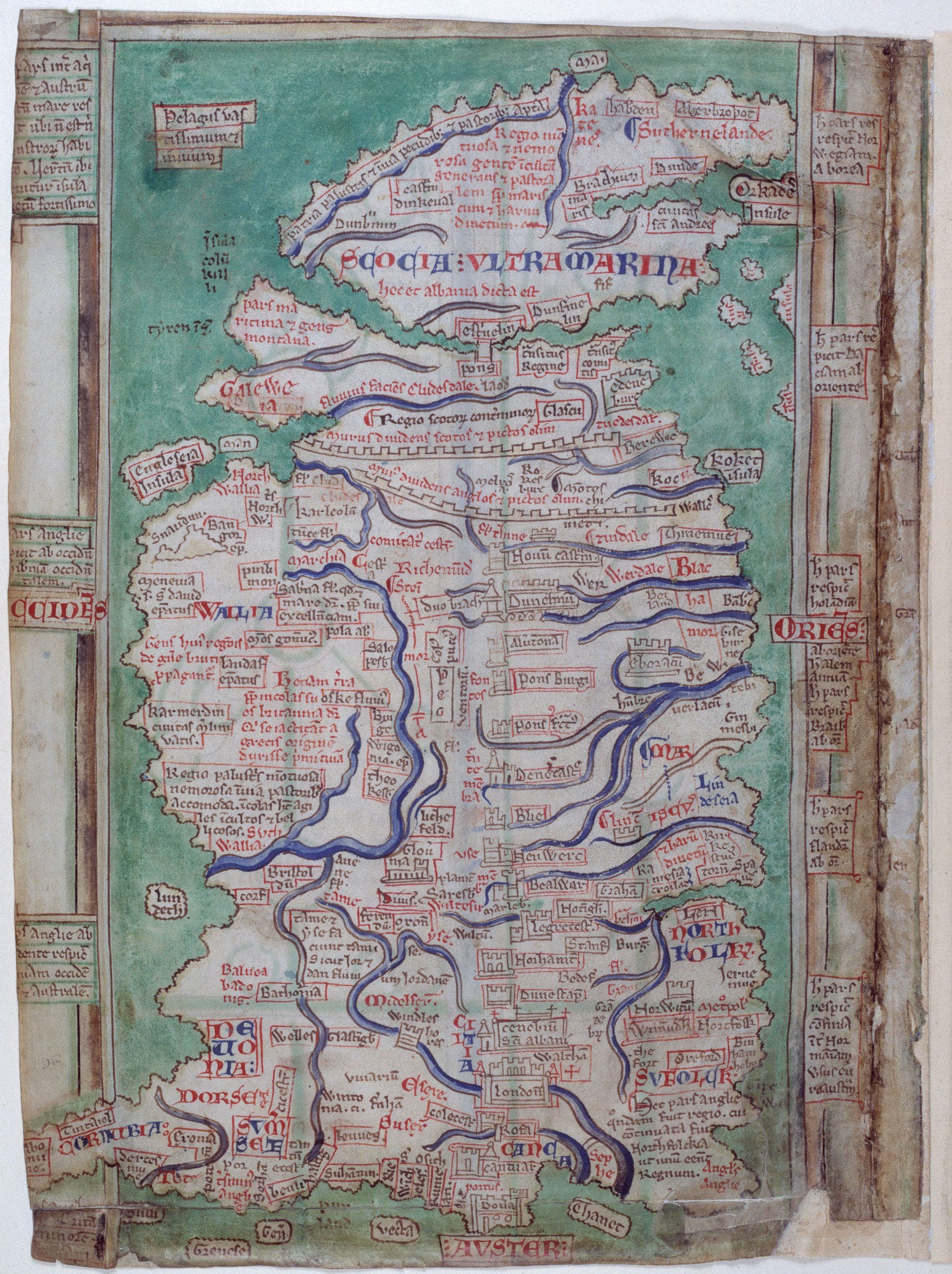
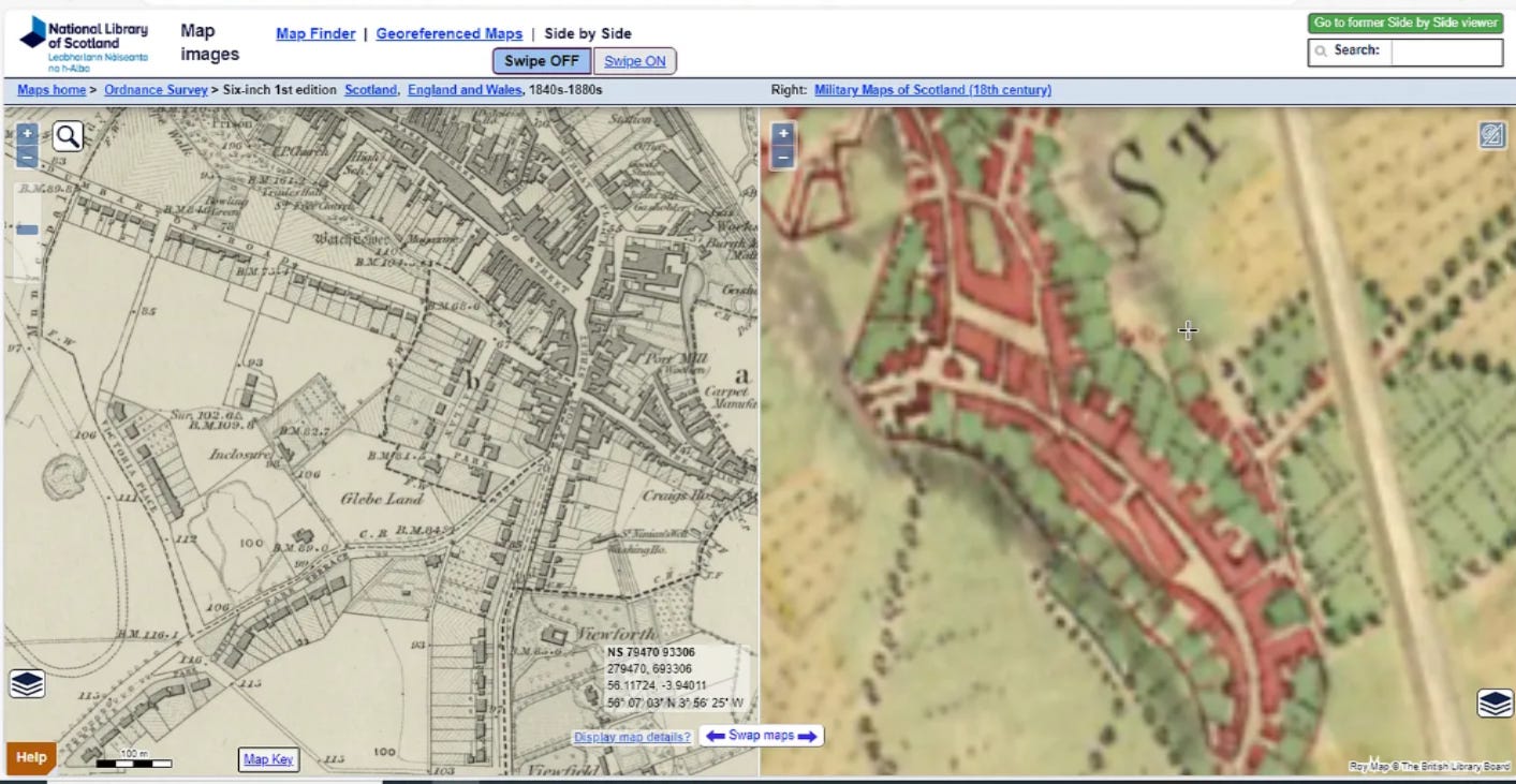
Where to begin? Given the military significance of Stirling into the 18th century there are a series of detailed maps that show the defences and these reveal a lot of significant detail.

This map shows eight potential bastions two of which were circular and are very familiar: the one in Alan’s Primary School and the Thieves’ Pot in The Thistles.
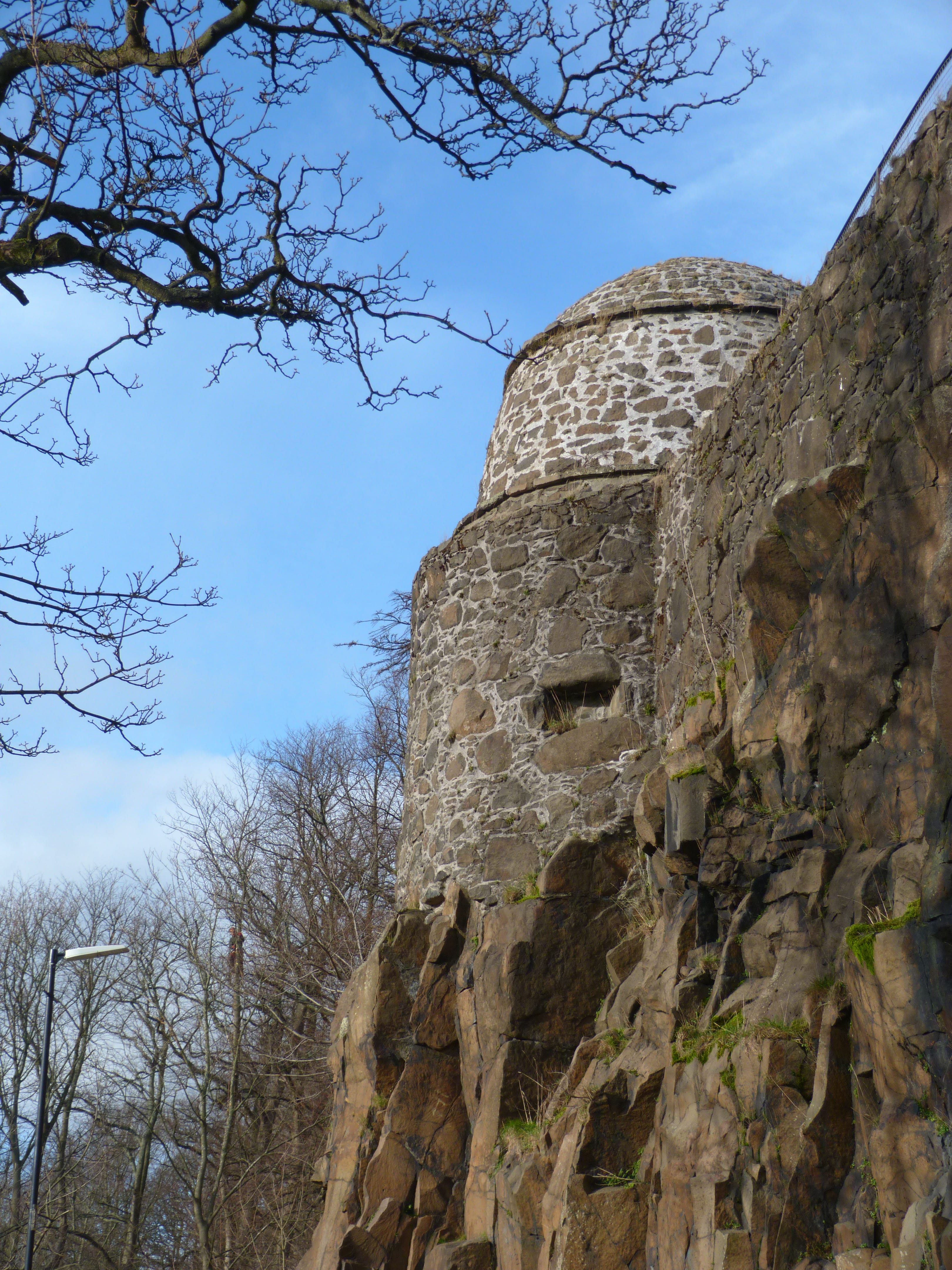
The Bastion at Alan’s Primary School.
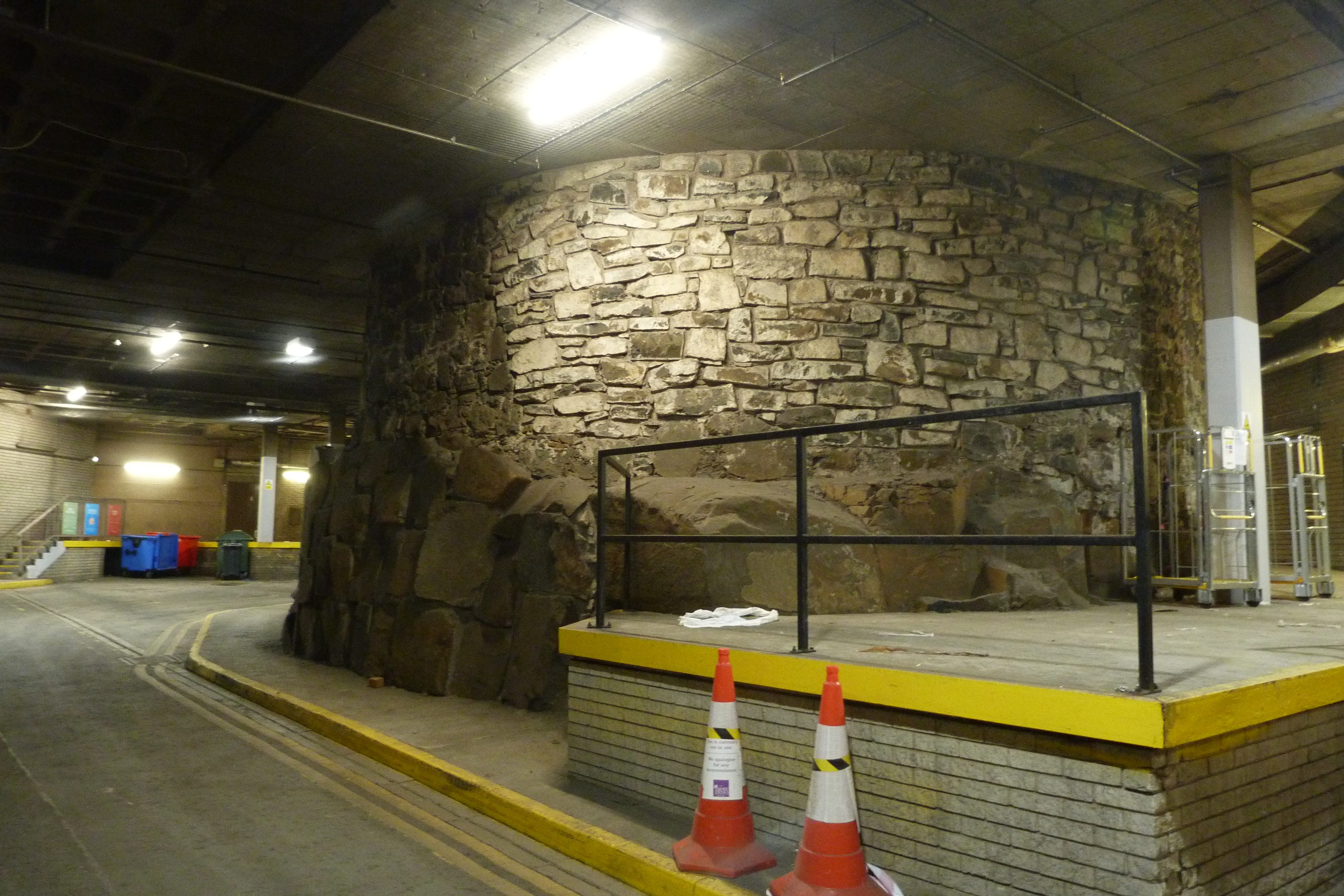
The basement of the Thistles and the Pot!
Now most of the other potential bastions don’t appear to have been buildings as they are not depicted with a return wall. But when we look at three 17th and 18th depictions of the wall there are other buildings on the wall.

Stirling in the Time of the Stuarts by Johannes Vosterman (1643-1699) courtesy of the Smith Museum and Art Galley compared with the John Laye Map (by Dominic Farrugia).
The potential bastion to the left appears to lie in the grounds of St Mary Erskine which is currently the Youth Hostel on St John Street.
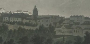
A detail of the above late 18th/early 19th century view of the Town and Castle of Stirling showing two buildings on the wall. The right one may be the Allan’s Bastion (?) and the left one perhaps the Mary Erskine one?
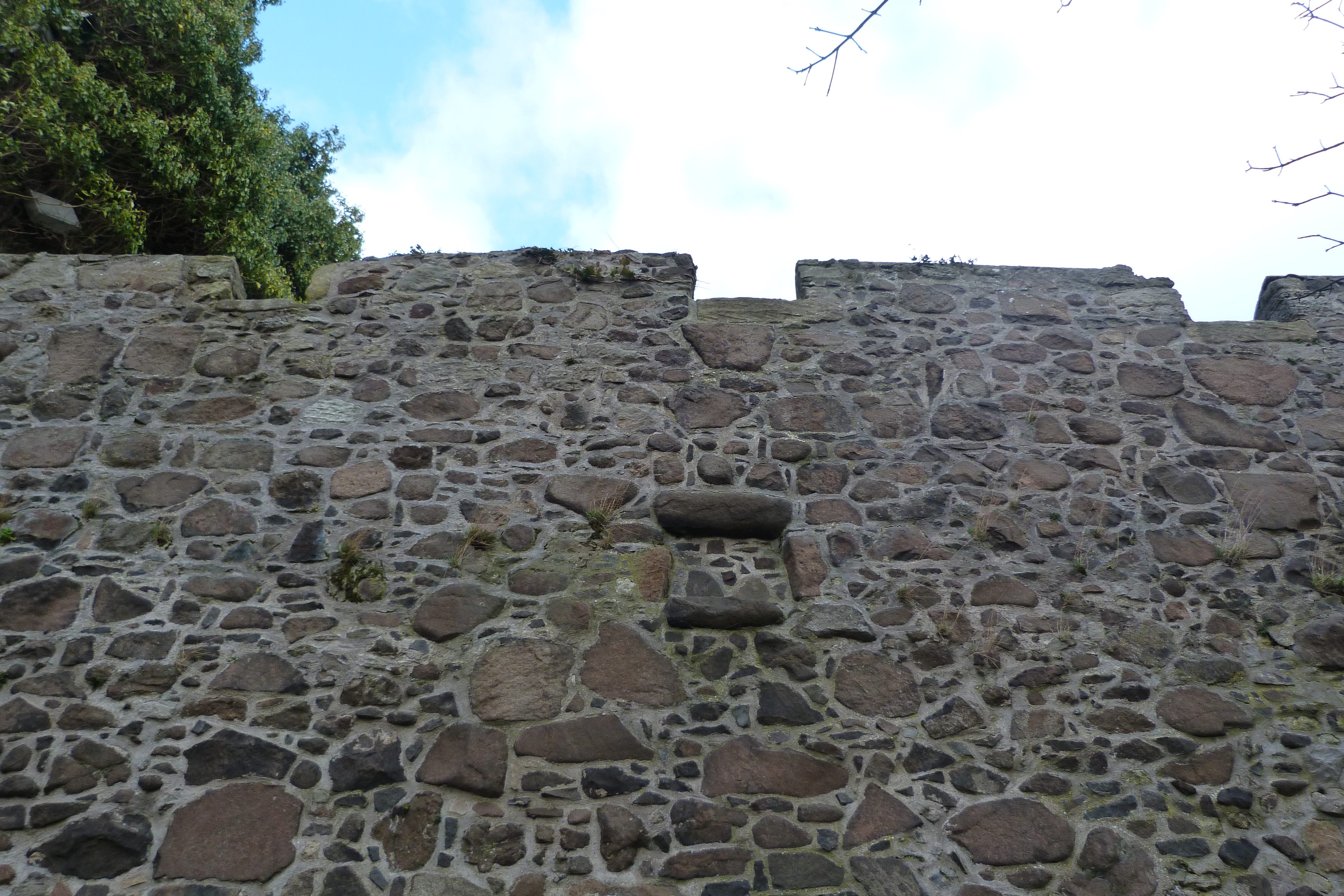
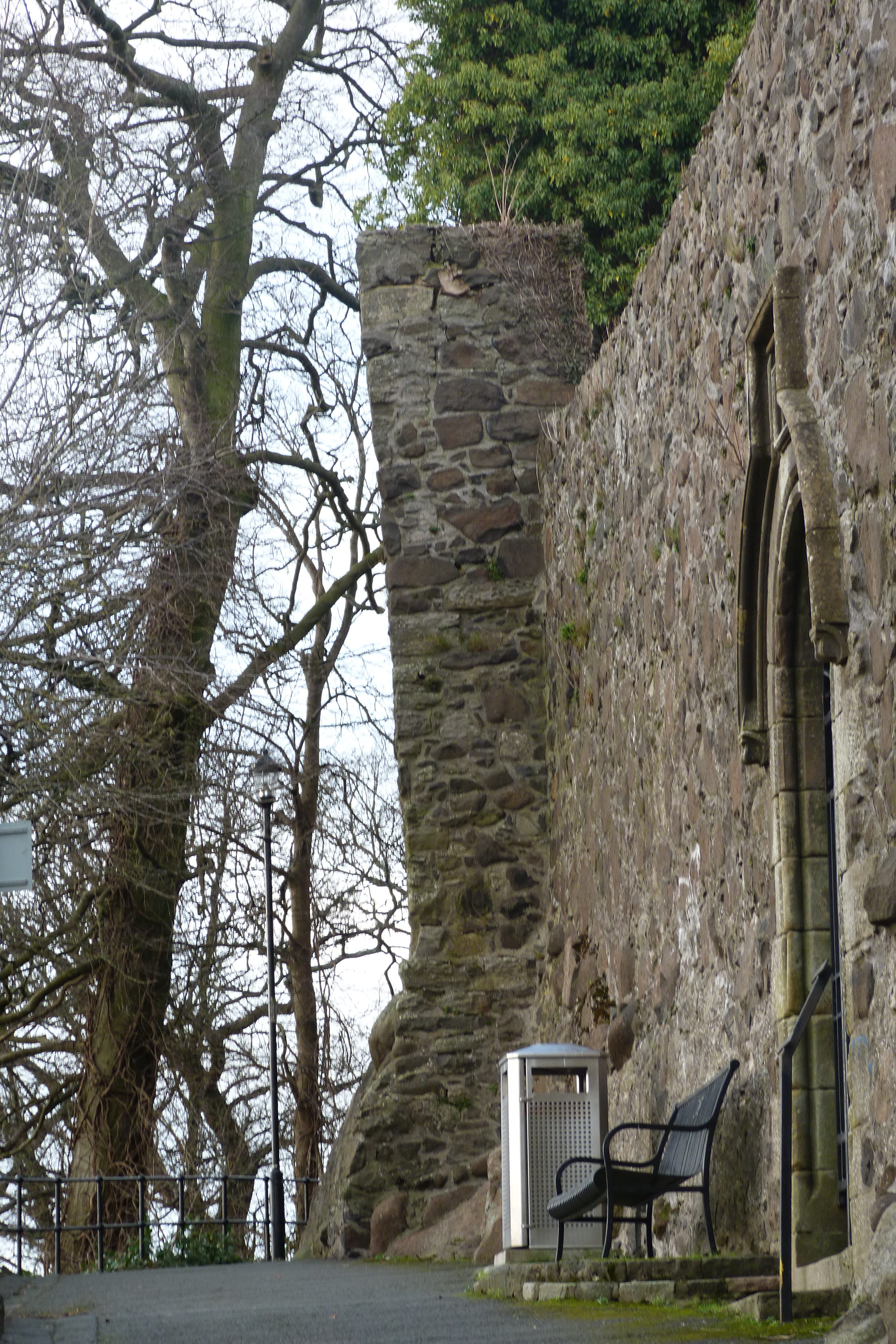
This is the Mary Erskine Bastion, but we think that the crenulations at the tope are later but more of that in Part 2. The second picture of its side shows another gun loop previously missed.

A final image, purportedly from the mid-18th century following the ‘45 appears to show a third bastion which may be located in the cemetery to the west of the Church of the Holy Rude.
This cemetery bastion plus the city wall will be the target of our first field work on the 7th and 8th October from 10-3 each day. If you’re free why not come for a visit?
A very interesting read! Thank you.
This is fascinating stuff, Murray. So much new information!