


New Light on Dumyat: Capital of the Maeatae.
New discoveries from Stirling's most iconic prehistoric monument.

I am on holiday in Harris this week so thought I’d give you a slightly tweaked version of my most popular blog.
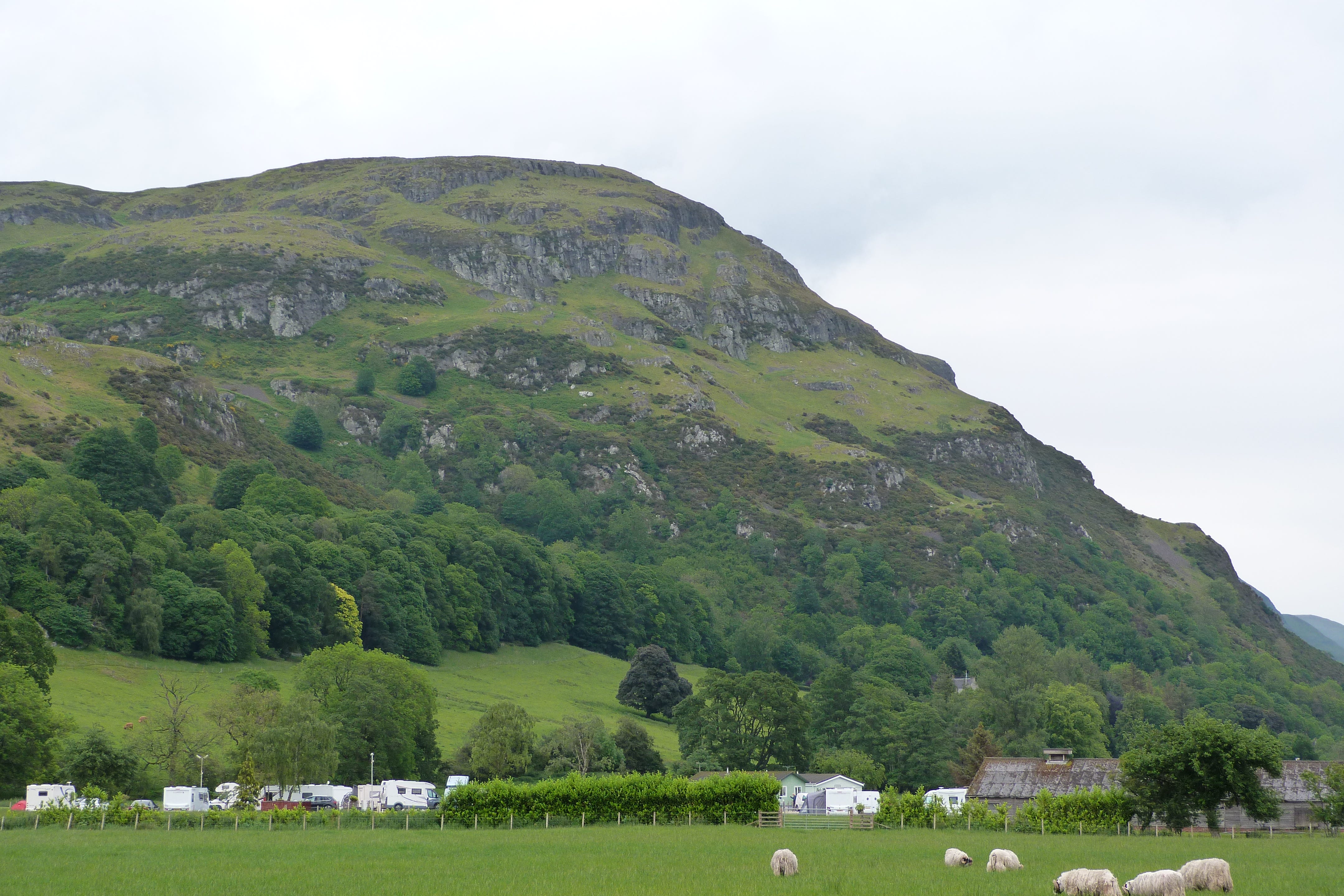
Today’s article focuses on Dumyat (Dun Maeatae) which dominates the Forth crossings at Stirling. I have written before about the Maeatae and how their defiance of the Roman Empire resulted in Scotland’s only recorded genocide. My collaboration with Professor Gordon Noble of Aberdeen University has demonstrated that the fort was occupied between c 500 BC and c 700 AD. Our most recent phase of work has identified that the site is much bigger than previously thought and we may even have identified an unrecorded burial mound. Our excavation of the topsoil also revealed that the Maeatae were also still using Stone Age technologies!
The first plan!
But lets begin with a 70 year old survey undertaken by the former Royal Commission on Ancient and Historical Monuments of Scotland. This wonderful organisation used to undertake systematic surveys of large chunks of Scotland, but time, money and political changes caught up with it and it was folded into Historic Environment Scotland and no longer does anywhere near the scale of work it used to do. These volumes are all excellent but their quality varied with the current social mores. The 1963 Stirlingshire volume is an odd one, the work was done in the 50s and it occasionally smacks of a bureaucratic arrogance: interpreting rather than recording. However, this volume contains our first record of the fort even though the name had been known and recognised for its significance since at least the Edwardian period.

As you can see the plan is basic and also is heavy on the interpterion. The plan shows a central citadel surrounded two key ramparts and some smaller ones. The ramparts were noted to contain vitrified material which indicates that the fort was set fire to and the temperatures reached in excess of 1000 degrees centigrade. The fires must have burned for a several days and its would have been an awesome site: the entire hill in flames, the smoke visible for miles and fiery red eye of destruction for even further.
Moving forward.
Now when I first started working in Stirling I walked to it and began to think is there more here? There are a series of natural gullies beyond the fort’s core… might they have been utilised as extra defences?
The first stage was to try and map them and so with some help from the Society of Antiquaries of Scotland and the Ochils Landscape Project we got AOC Archaeology to do a new survey.

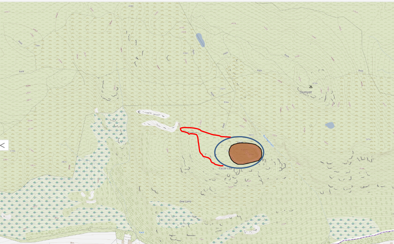
The new survey identified additional ramparts and also mapped a series of natural gorges (red dotted line) which appeared to add an extra layer of defence. I have also subsequently identified a few more (blue dotted line).
Our excavation in 2019 in the northern gulley confirmed it had a rock cut ditch at its base full of Corylus avellana charcoal which was dated to 1500 24±BP (SUERC 94074) which when calibrated to 2-sigma gives a range of AD 437-631. The date generously supported by the Northern Picts Team.
In 2023 Professor Noble and I went back to the fort and we are still writing those results up but watch this space.
In early May of 2024 I went back again and this time focussed on the area in the yellow circle. If I was correct about the gorges being used as an extra defence then this must be the external entrance to the fort.

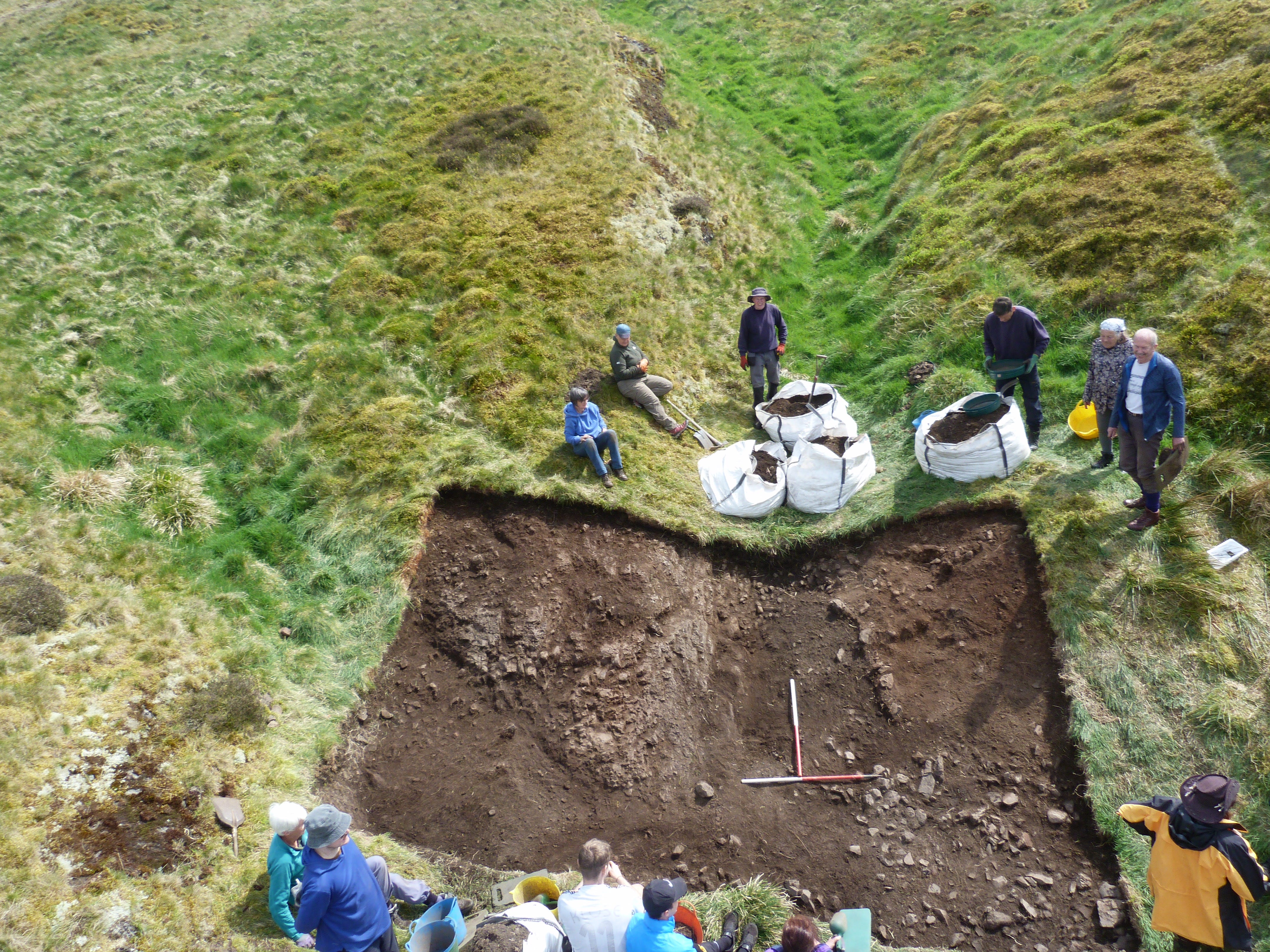
May 2024’s fieldwork.
So we spent three days stripping and cleaning and confirmed the presence of a roughly paved path and a mound to the south-west of the entrance (on the right).
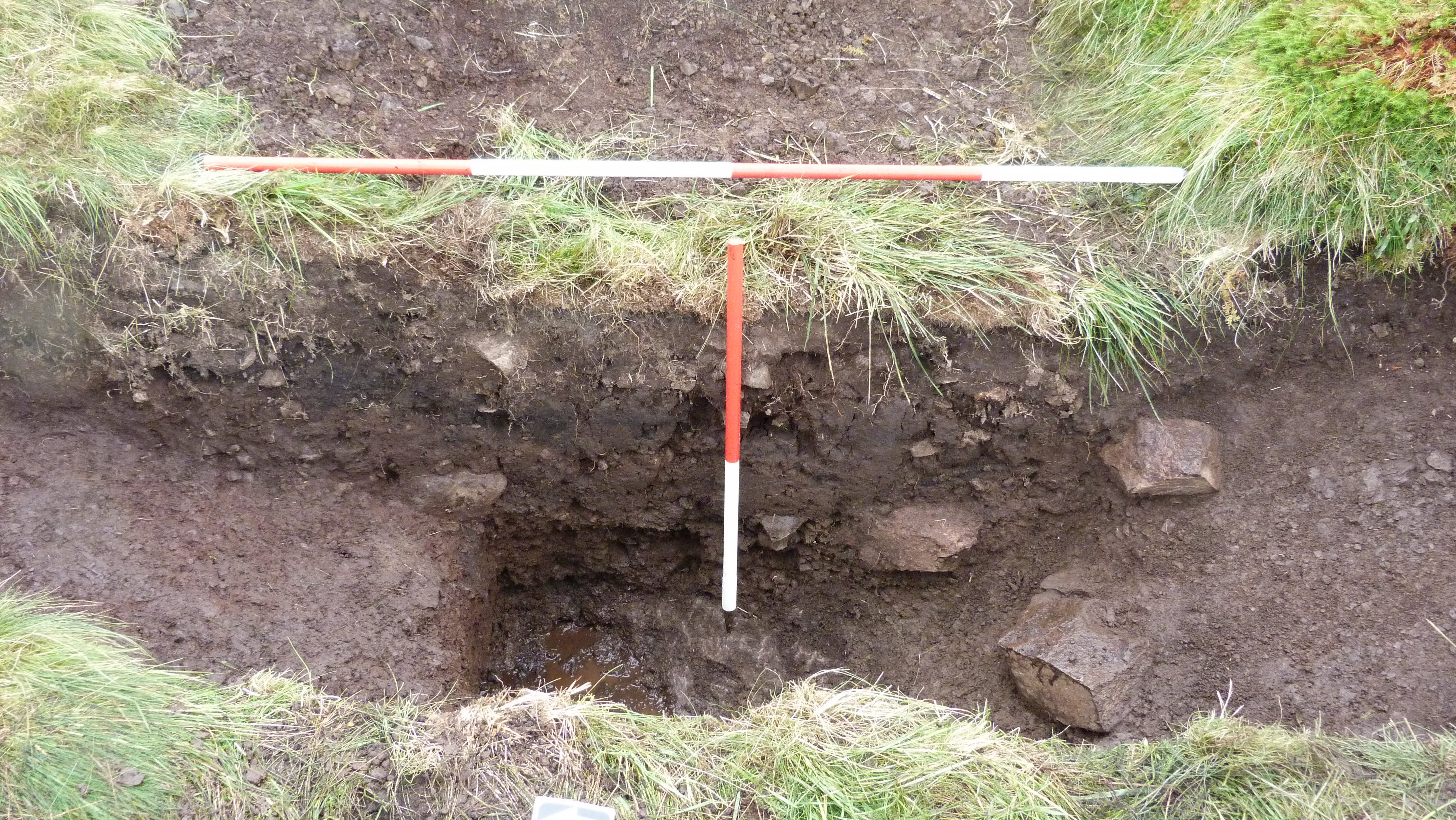
The mound was clearly artificial and was formed by a stone kerb and sealed a pit. We never excavated the pit as we ran out of time…but what did it contain? At present we have no idea but it is possible that we have a burial mound, which would be absolutely astonishing (dare I say the King (or Queen) of Dumyat? Editor’s note….please don’t Murray …that’s sheer speculation)) but we have much more to do so watch this space.
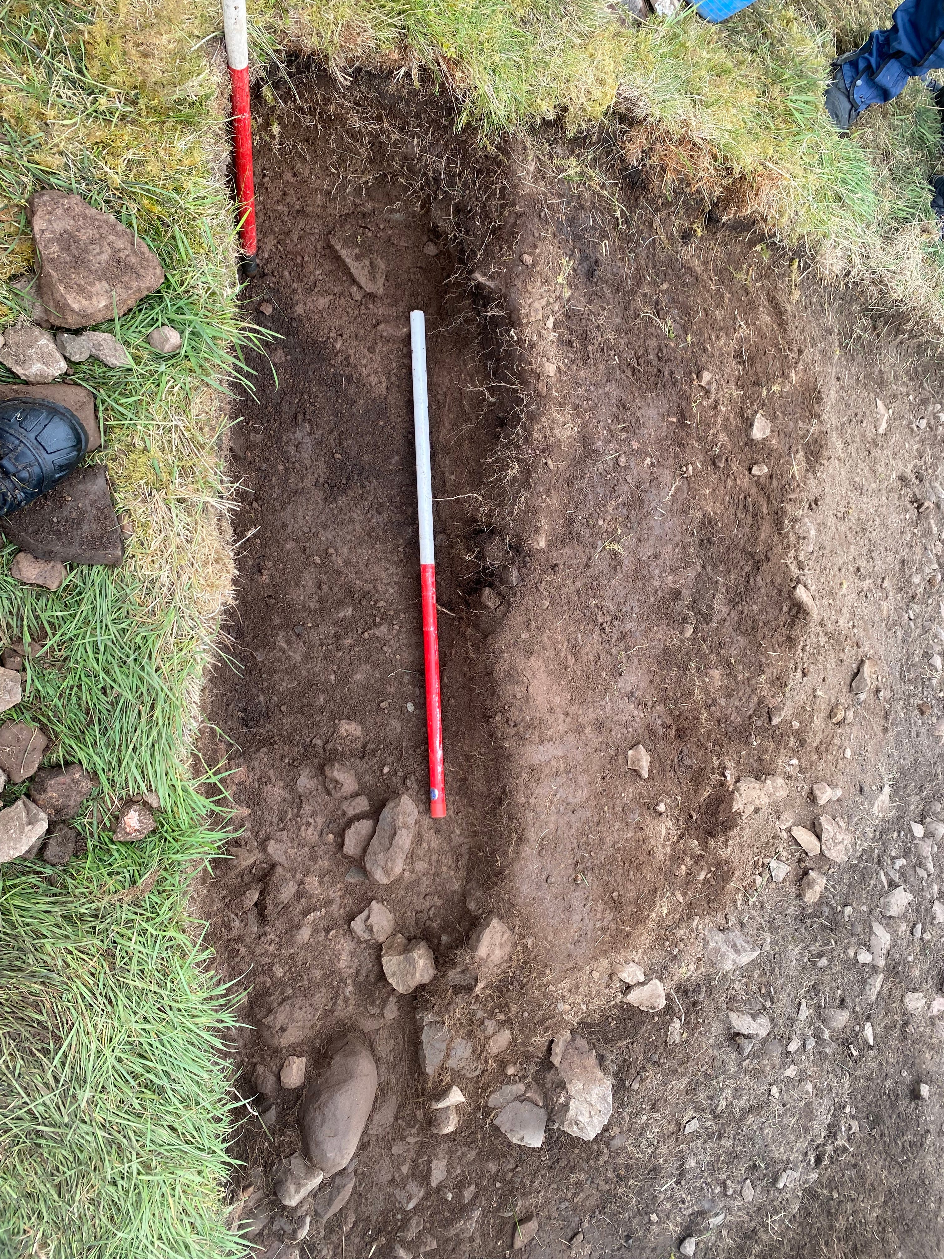
The stones to the bottom are the kerb, the black soil at the centre is the fill of the pit.
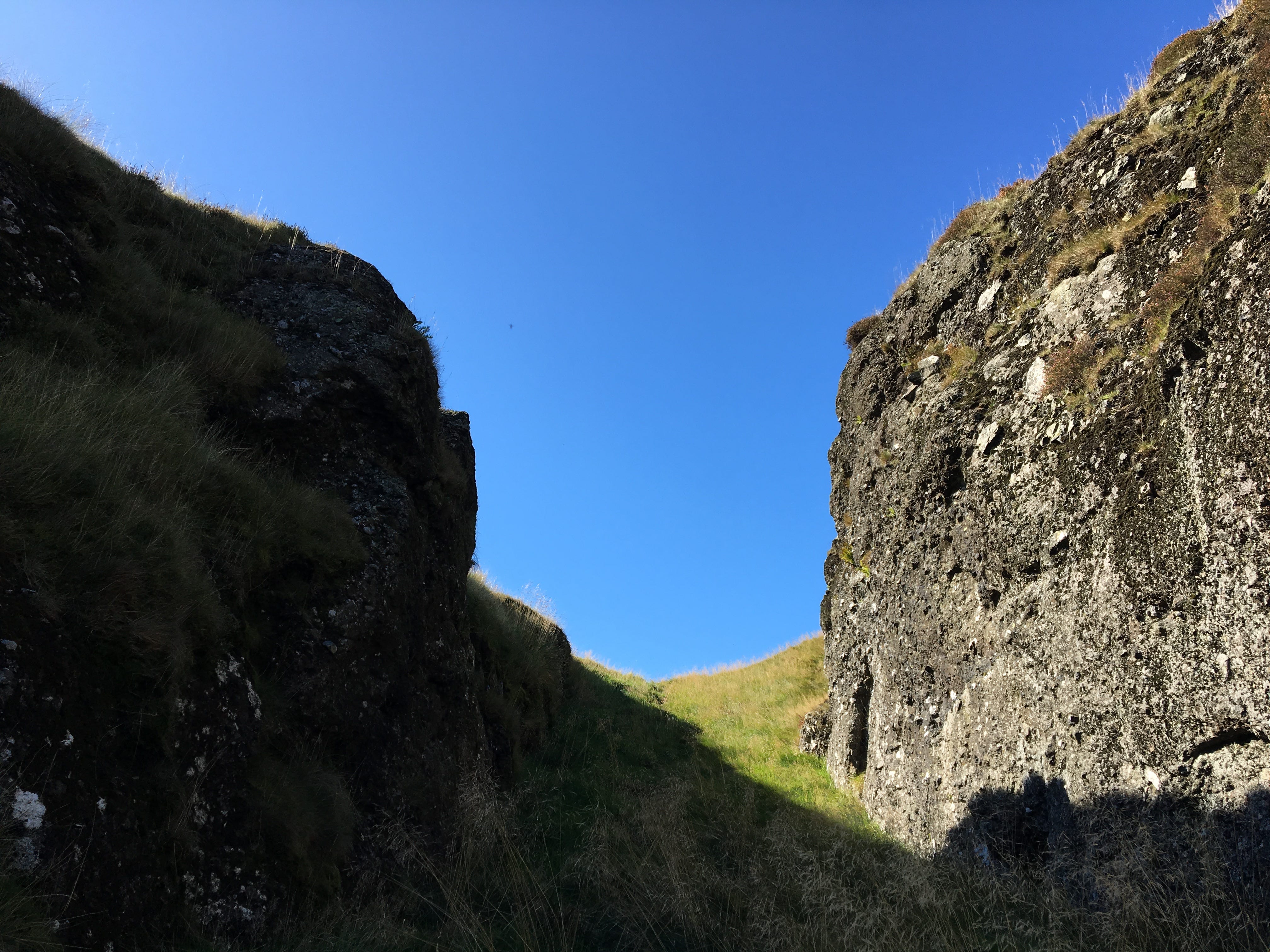
Of course now that we have a new entrance what lies to the west? An incredible bowl shaped natural arena, a place where assemblies might be held?

The logic of this then drew me to another natural gorge to the west of the arena…. was this the original access route?

This gorge like entrance recalls the design of the more famous Dumbarton Rock capitol of Alt Clut, which was famously captured by the Vikings in a 3 month siege in 870. This new route takes you from the south at Blairlogie and highlights the link from the Forth. It also makes the whole fort far more impressive!
Conclusions!
So to recap some very limited research has tripled the size of Dumyat (brown 1950’s; blue within the gorges; red the arena and entrance gorge)…..but what exactly is in these extra areas? With landowner permission we hope to return in May 2025, but we receive no funding so all of you make it happen!
Have a question? Get in contact!
Fascinating Murray. Thank you. Enjoy your holiday! 😄